Saturday, 12 September 2015

Hobbiton the movie set


Perhaps the site achieving the most acclaim was made famous by the movie the Hobbit and the Lord of the Rings Trilogy.  We   knew we had to visit it, if only for our grandchildren's sake.

There were 45 of these in ground houses, called Hobbit holes

A number of the Hobbit holes had gardens, all maintained and cared for.

The occupation of the Hobbit could be discerned by carefully examining the surroundings

Originally they were built for the movie set, but later were constructed from natural materials to last for years.

All with the exception of one was built into the hills each spread over 15 acres.
No detail was left out. Even the lichen on the posts was added in some places to add authenticity.

They chose the site, not only for the picturesque terrain, but the added features of a little lake and ponds.

In the foreground is a chimney seemingly coming out of the ground,  in fact there are several in the background as well


Some were built to various size to accommodate filming requirements.--my attempt to look like a hobbit!

The overall site was beautiful This is an early spring shot on gorgeous day.  We picked a good one.

Even laundry was hung out.  The tree to the left is actually artificial, made from silicone and the leaves all sewed on .

I prize this shot, as it captured the character of the place for me.

Yep, a little window, on the side of a hill, a reminder that there was a home in there.

They spoke of the ales and beer brewed on site in keeping with the Hobbit tradition. 

This is "The Green Dragon" where the local brew and good times were to be had. We settled for the tamer Ginger Beer.
I was rather skeptical about the whole venture given the $75 tour fee, but in the end I was pleased.  The guide provided the background necessary to appreciate the experience.

The shire is located on a 1200 acre sheep farm two hours south of Auckland near a town called Matamata.

At the end of the tour we sat down and had a pint of  the tame stuff.


Gandalf  in a life size rendition

Saturday, 29 August 2015

90 Mile Beach


Travelling on a bus rarely generates a whole lot of excitement at the best of times. Of course if there are sites to see the appeal improves dramatically. On this occasion not only were the sites appealing, but the bus itself was somewhat different. Most of all it was what we were travelling on that made this trip unique.  For approximately 80 kilometers we drove on hard pack beach sand.

The novelty of the situation played upon my mind as the kilometers clicked by.  It was low tide and the expansive beach spread like a featureless runway.The sand was so smooth, nary a bump jarred my reverie.  On our left dunes of sand marked the beach head and the pounding surf of the ocean to the right was a constant reminder of where we were at.

This beach is called 90 Mile Beach named in the 19th century.  Horses
 would carry goods along the beach. Calculating how far a horse travels in a day it took three days to make the trip from one end to the other or 30 miles a day. However in sand the progress is impeded ever so slightly by softer under footing, hence the presumed miscalculation. It is actually about 85 kilometers.

We had to navigate streams of water,  periodically.  From what I gathered the ebb and flow of the tides flattened the stream beds out only proving to be a minor obstacle for the buses.

We stopped at our first creek bed which you can see to the right.  Arendje was taking a picture of our travelling companions. The bus provides perspective as to the breadth of the beach. Probably several hundred meters separated the ocean from the high tide mark.

This beach is a designated highway in New Zealand, As it is in the extreme north of the island it is not used extensively. We only saw a hand full of vehicles, mostly fishermen.


Saturday, 22 August 2015

Te Paki Giant Sand Dunes

Dunes occupy about 1,100 km of the New Zealand coastline. An impressive dunefield stretches 130 kilometres from Paekākāriki to Pātea on the west coast of the North Island, and several kilometres inland. Wide, almost flat beaches are framed by fore dunes, formed when wind-blown sands become trapped by plants and driftwood on the beach. If there is a ready supply of sands on the beach, more dunes may develop in front creating the wave like structure of the dunes. The dunes further back may be
stabilized by plants, 

or blown inland if there is insufficient  plants to impede their progress.

We engaged in what appeared to be the rather reckless sport of sand surfing.  Looking at the hill I thought one must be either addled or an adrenaline junky to consider this.  I must be both, guess who went first.  Right! Me!  All of them were younger than me, but with obvious more common sense.  It soon became apparent that sand surfing may look risky, yet was much tamer than first appearances, and still fun.  

The dunes are 17 kms from Cape Reinga.  A stream became our road with dunes towering above to the left and right.  The bus ride through the stream bed another first for me.


Cape Reinga

Cape Reinga  is where New Zealand begins or where the Maoir's  end their journey of life jumping from a gnarled pohutukawa tree, believed to be over 800 years old. According to Maori oral history, the spirits of deceased Maori leap from this tree into the ocean to return to their ancestral ancestral homeland  of  Hawaiki.

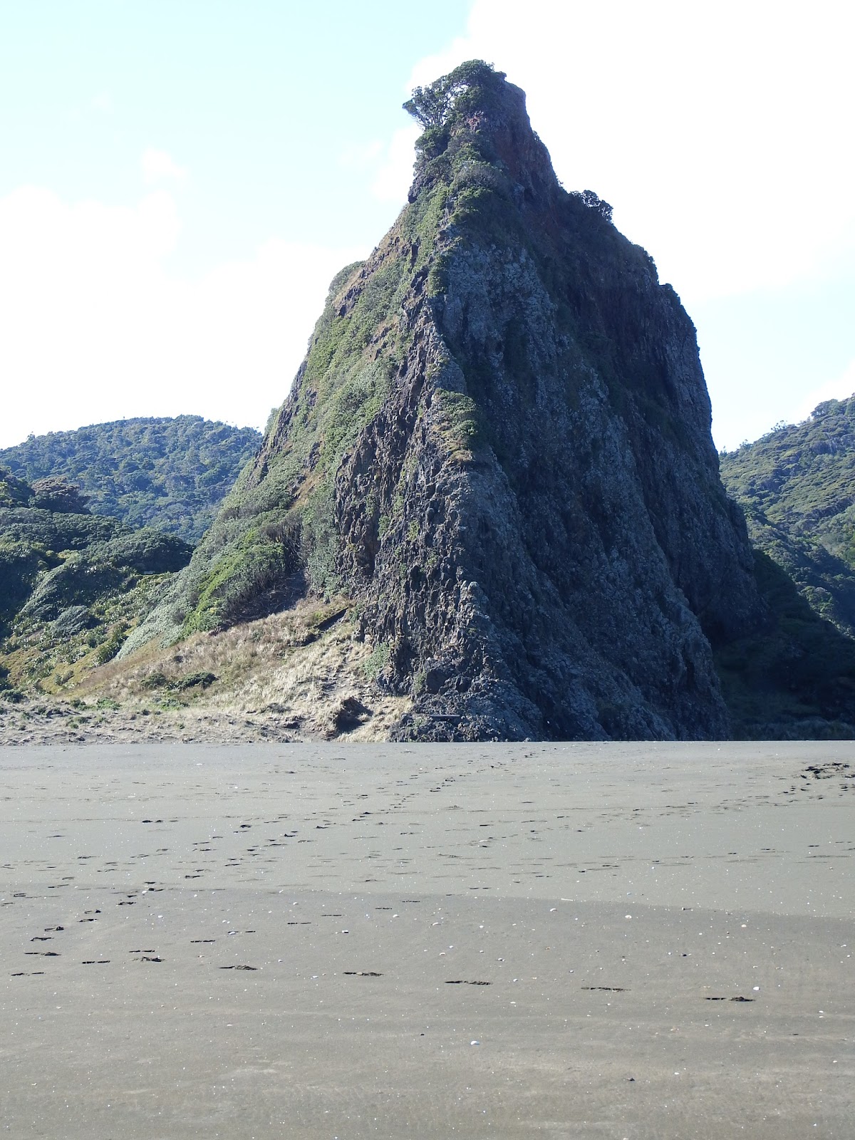
It is also where  Pacific Oceans meets the Tasman Sea... a literal collision of two giants with swirling white masses of waters to mark the spot.  This is considered sacred land and it indeed has an almost haunting presence about it.

The Pohuntukawa tree pictured to the right apparently never flowers.  It stands along on this barren chunk of rock defying wind and waves for centuries.  This is taken with a 60x zoom. It is a long distance from the light house.  Part of the oral legend springs from this particular tree.


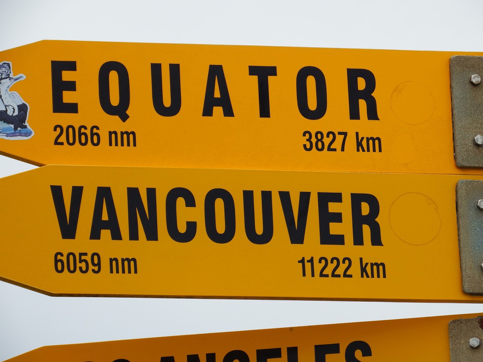
This northern extremity of New Zealand is best described as a 100 kilometre peninsula with a scant few kilometres separating the vast ocean bodies. Red sands carpet the hillsides.  These are thought to be the legacy of eons of wind swept sands from the vast continent of Australia.  Winds were indeed strong out of the west on the day we ventured to this remote and intriguing site.

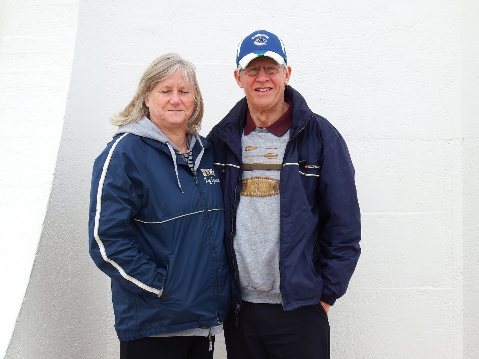
This was part of a day long adventure by tour bus.  Being a winter day there were few passengers aboard and not too many more at the actual cape.  Consequently we enjoyed near individual attention and discussion with the tour guide who offered a bus load of information throughout the course of the day.  Additionally we had front row seats with a view that would been hard to match in a car.

I took pictures galore. The day was pleasant enough, sufficiently warm to allow us to linger at the more interesting sites. We took up conversations with the other passengers from Germany, England, Australia and elsewhere. 

The next three entries are all part of this trip.  Arendje is after me to arrange trips to the islands but I am finding enough here to captivate my interests for a long time.

Friday, 24 July 2015

Karekare Waterfall and Beachl

 Karekare waterfall, known by the Kawerau people as ‘Te Ahoaho' or ‘pendulous white thread'.  It is a short up hill walk to the trail head. The falls were actually a pleasant surprise.  The falls have almost a straight verticle drop with a few cascades from approxiately a 30 meter height.  From there we walked down the hill and headed to the alternate beach trail. This is preferred access to the beach as the
Jane Campion’s Oscar movie was shot in part at Karkare, with everyone talking about the beautiful 

 other route 
necessitates
navigating a shallow 
stream. 

black-sand beach.

Karekare beach is located on the west coast south of  Piha Beach.  It is about  50 minute drive from  Auckland.  It is the black sand  that first grabs your attention.  In the summer this sand would likely get pretty warm under foot.  Surfers were out taking advantage of the surf in spite of it being mid July.  It was a sunny day and we got there relatively early so there were very few on the beach.  This is designated as a wilderness area, and part of the Waitakere Ranges Regional Park. The surf on this beach is impressive as are the walking trails.
This beach has its fair share of hazards with a strong rip tide during outgoing tide. Swimmers are advised to only swim between the flags and not at all when lifeguards are not present.
To quote other admirers of this site Karekare has attracted some of New Zealand’s finest painters: Albrecht, Binney, Blomfield, Buchanan and Siddell.
Writers like Curnow and Stead have written about it, filmmakers like Jane Campion (The Piano), Barry Barclay and Niki Caro (Memory and Desire) have set major films there. The landscape is both magical and powerful, a magnet for photographers.


Saturday, 20 June 2015

Regional Parks

 There are 35 Regional Parks in the Auckland Area and administered by a local Council. These parks respond to a wide range of interests.  Each offering something slightly different from the other.  They include marine reserves, bird sanctuaries, old growth forests,  historical sites, walking and hiking areas, beaches, waterfalls, recreational sites, botanic gardens, volcanic and geologic land forms and alpine  retreats. As many as we have been to we have yet to be disappointed.  The vast majority are located on or around beautiful beach heads providing panoramic views of New Zealand's 
rich and diverse coastline.

Blustery winter days offer  less hospitable conditions , but no less appealing visually.  The pounding surf, under somber grey skies provide a stark contrast to the sun lover's sun bleached perspective.  I rather enjoy the contrast, as it graphically reflects the sculpting
 influences of wind and water
 on the rugged landscape.

My company soon abandoned me to the wind and rain as they sought warmth and shelter in the car.  I took some of these pictures while making a futile attempt to protect the lens and 
myself from the splatter of rain 
and the ever present wind.

 A combination of storm surge and high tide left very little beach to walk upon. Walking over some rocks was an invitation to get wet and I did as a big wave came splashed both Arendje and I. You can see where it happened in the picture above.  That is Arendje in the blue coat.

 Tawaharanui Regional Park is where all these pictures were taken.  It is particularly noted for the abundance of bird life.  The park is fenced to keep out unwanted predators and it has apparently paid off. There were birds of all kinds around.   The one on the right could be seen everywhere where there was a green spot. They shared the green spaces with sheep.  I gather they were being used to keep the grass down.